Hurricane Helene is expected to land on Florida’s Big Bend Coast as a sizable Category 3 storm during the evening hours of Thursday, September 26. When it does, officials warn of life-threatening conditions that could include maximum sustained winds of 120 mph, heavy rainfall, flooding, and storm surges ranging between 15-to-20-feet above normal tide levels.
[Related: The average hurricane season is officially more intense.]
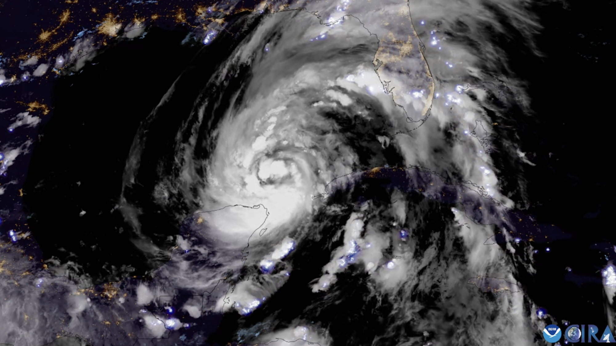
These estimates, updated in real-time by meteorological experts at the National Oceanic and Atmospheric Administration (NOAA), rely on spacecraft such as its Geospatial Operational Environmental Satellite 16 (GOES-16) to provide regular visual and analytical data. Launched in 2016, GOES-16 is just one a fleet of similar satellites, and is designed to monitor the Earth’s atmospheric conditions by regularly capturing images of the planet using 16 channels of light. And thanks to Colorado State University’s Cooperative Institute for Research in the Atmosphere (CIRA), many of those remarkable images are available online to illustrate the incoming storm’s intense power.

On Thursday afternoon, CIRA posted a composite image on X of the lightning flashes (also known as “robust convection fires”) occurring within Hurricane Helene’s eye wall as it made its way towards the Florida coastline. The lightning isn’t confined to the inner portions of the storm, however. Late Wednesday evening, CISA showcased similar “lightning spirals” that take place in the storm’s outer bands.
Part of Hurricane Helene’s rapid strengthening is due to record-setting warm temperatures in the Gulf of Mexico. This can act as “high-octane jet fuel” for the storm, according to a University of Miami hurricane researcher speaking with The New York Times on Thursday, adding that water in Helene’s path is “roughly the ideal temperature for a warm bath.” In one time-lapse posted to X, CISA illustrated those high temperatures that lay ahead of the storm as it neared Florida on Wednesday.
GOES-16 isn’t the only tool tracking Helene from orbit. The International Space Station’s own exterior cameras recorded the hurricane as it passed over the hurricane at roughly 12:50 EST on September 26 from a height of about 260 miles above Earth.

Hurricane Helene is estimated to make landfall around 7pm EST in Florida’s Big Bend before quickly moving north through the Appalachians and the Ohio Valley before veering northwest as it loses strength. For real-time information, visit the US government’s disaster information page for more details.